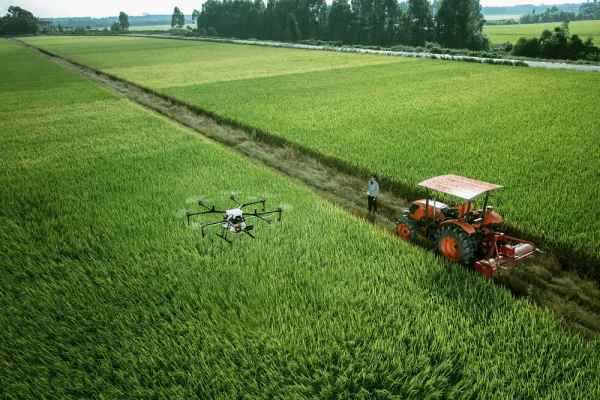
On June 16, three plant protection drones equipped with the Beidou navigation satellite system lined up to fertilize the leaves of date trees in a 500 mu date garden built by the 46th Regiment of the Third Division.
With the help of the Beidou satellite navigation system, the drones will be able to fly autonomously according to the route and height planned in advance, and fertilization error will not exceed 5 cm, said Bose Goulang, a drone pilot.
"The drones carry 15 kilograms of agents at a time and spray for 10 minutes. It used to take 10 minutes to spray an acre of land with a tractor. Now it only takes about 30 seconds." Company worker Zhang Guoxiang said, "The spray is more uniform, the effect is very good."
Good results, time is not long, how much is the cost? Zhang Guoxiang calculated a sum of money: 25 yuan for each mu of land operated by tractor, 15 yuan for each mu of land operated by plant protection drone, 10 yuan for each mu of land, 300 yuan for each time of his family's 30 mu of date orchard, and 1200 yuan for four times a year.
Not long ago, with the aid of its counterpart in Xinjiang platform, the 46th Mission cooperated with a plant protection drone manufacturing company in Dongguan, Guangdong to hold a plant protection drone operation on-site observation meeting. The plant protection drone equipped with Beidou navigation satellite system can separate human and medicine and operate autonomously. The cost is not expensive and has been recognized by employees.
"Now one phone call and the plant Protection drone company sends someone to work." In previous years, using tractors to fertilize dates would have broken not only the branches but also the red dates, said employee Musa Maimatitilsun. Now it is much easier. At present, many workers of the 46th Regiment are using plant protection drones equipped with Beidou navigation satellite system to fertilize date trees.
In recent years, the XPCC's agricultural machinery extension department has actively carried out experimental demonstration work of satellite navigation automatic driving technology, and applied the technology to agricultural production such as cotton seeding. Autopilot system combined with an efficient and precise seeder make agricultural production more wisdom, staff only need in driving indoor navigation debug set on the touch screen parameters, drill can be straight forward, per km line error is less than 2.5cm, homework after the bench border line accurately, sowing line end of the straight line at the end, replayed, line to the edge. At present, three Shi Tumushuke city has 700,000 mu of cotton by unmanned seeding machine sowing seeds. According to reports, at the harvest time, relying on the Beidou satellite navigation system, the locomotive picking head is precisely aligned with the cotton line to avoid collisions with the cotton plant, which reduces the rate of cotton falling and increases the net rate of cotton picking by 2%.


